
Monrovia ZIP Code Coverage
Two postal entries matter when a Monrovia address is sorted by postal code. The Monrovia ZIP code labels are useful for delivery and for narrowing a record request, but neither one is a ready-made resident list. The inspected USPS material does not provide a stable neighborhood-by-neighborhood prose boundary inventory, so the safest description stays at the postal-territory level.
| ZIP | Areas Covered | Post Office | Notes |
|---|---|---|---|
| 91016 | Principal Monrovia delivery ZIP, including the incorporated city and surrounding postal territory | Monrovia Post Office and local delivery unit | Postal city and ZIP do not prove city limits; check the parcel jurisdiction |
| 91017 | Additional ZIP associated with Monrovia | Monrovia Post Office and local delivery unit | Inspected USPS text did not establish an exclusive PO-box-only status or a stable street boundary |
That distinction prevents a common mistake. A Monrovia postal label may cover territory outside the incorporated boundary, while an address inside the city may need a different jurisdiction check for a county service. Do not assign a street or household to a ZIP-wide neighborhood list unless USPS returns that result for the full address. County parcel and city zoning sources answer a different question.
Note: A postal association with Monrovia does not identify an incorporated parcel or prove that a person lives at the address.
Verify Monrovia ZIP Addresses
Begin with the USPS address ZIP lookup, which offers Address and City & State modes. Enter the full street address, city, and state, adding the known ZIP when appropriate. The returned standardized ZIP+4 is the strongest postal-format result for that ZIP code, but it remains a delivery answer rather than a city-limit ruling.
The USPS lookup screenshot below shows the kind of address-first check that should precede a ZIP directory search.
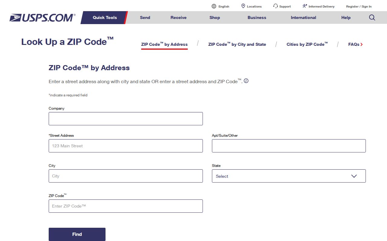
The postal result gives a clean value to carry into the next step. It does not establish an owner, occupant, parcel line, or municipal jurisdiction, so a mismatch is a signal to verify rather than a reason to discard the address.
There is no reliable official prose list of Monrovia neighborhoods by ZIP in the researched sources. Treat commercial boundary charts as leads only. A full address, not a place name alone, is what makes the USPS answer useful.
Monrovia ZIP Code Search Fields
The Los Angeles County Assessor Portal is the next check when the goal is a parcel rather than a mail route. Its public search starts with an AIN or address. The ZIP code can narrow an address search in the portal version, but it is not a city-limit filter and the public Internet interface does not offer an owner-name search.
| Field | Type | Required | Format or use |
|---|---|---|---|
| AIN | Text | Alternative | Assessor Identification Number; the most precise parcel key |
| Street Address | Text group | Alternative | House number and street; normalize direction and suffix |
| City | Text or dropdown | Usually with address | Use Monrovia, then test county postal-name variants when needed |
| ZIP | Text | Optional in portal version | Narrows the address search; does not establish the city line |
| Search or Reset | Buttons | None | Opens the parcel detail when a match is found |
The parcel card can show the AIN, situs address, legal-description shorthand, tax-rate area, use type, land and improvement values, building square footage, units, year built, lot dimensions or area, and a map link. A situs is the physical parcel location. A tax mailing address is where notices go. They must not be collapsed into one field, since a different mailing address can indicate an owner who is not at the parcel.
The Los Angeles County Assessor Parcel Viewer adds the geographic check. Search by address or AIN, zoom and pan, click the parcel polygon, read its map-book, page, parcel reference and AIN, then use the city zoning map to test jurisdiction. A mapped outline helps locate a parcel; it is not a surveyed boundary.
Note: Preserve every AIN digit, leading zero, and displayed punctuation when moving from the ZIP result to county parcel records.
Finding Monrovia Residents by ZIP
A ZIP code directory search works best as a sequence of checks, not as a single query that promises every resident. Each step supplies a different kind of evidence. The county assessor ties an address to a parcel, the GIS viewer shows mapped adjacency, and election tools either verify a known registration or provide authorized aggregate context.
- Run the full address through USPS and save the returned ZIP and ZIP+4. Keep the entered street spelling beside the standardized result.
- Use the address or AIN in the Assessor Portal. Record the situs, AIN, legal-description shorthand, and parcel facts; do not treat the assessment display as a household roll.
- Open the county parcel viewer and compare the parcel with Monrovia zoning or city maps. This is where an address carrying a Monrovia postal label can be separated from incorporated jurisdiction or unincorporated county territory.
- For a known person, use LA County Voter Registration Status only when the last name, birthdate, residence house number, and ZIP are already known. The form verifies one registration and cannot enumerate voters by ZIP or street.
- When a ZIP narrows the work to a named street, continue with the Monrovia by Street records walkthrough for address-keyed sources rather than treating ZIP as a substitute for street research.
California voter-file access is narrower still. Elections Code Sections 2180-2194 limit who may receive voter information and how it may be used. A permitted requester can apply for a county or state file with the required purpose and security commitments, but that channel is not a general ZIP resident browser. County Reports of Registration can provide city or precinct totals without publishing a name at every address.
A ZIP-wide result should therefore be read as a delivery or aggregate clue. A parcel-level result can support an assessed-owner question. Neither result, by itself, proves who is present in a household today.
Note: A ZIP narrows delivery and aggregate context, but an AIN and situs are still needed to test parcel jurisdiction.
Monrovia ZIP Contacts and Service
Different custodians handle different parts of a ZIP code research trail. The service route matters when a portal fails, when a parcel needs a jurisdiction answer, or when a known document must be requested from the county.
| Service | What It Handles | Access Channel |
|---|---|---|
| USPS ZIP Lookup | Full-address delivery ZIP and standardized ZIP+4 | Online Address or City & State lookup |
| LA County Assessor | Address or AIN parcel detail and assessment facts | Public portal, parcel viewer, or county public service route |
| LA County GIS | Parcel geometry, map references, and adjacent parcel selection | Free interactive Parcel Viewer |
| RR/CC Real Estate Records | Recorded deeds, liens, easements, and legal descriptions | Norwalk appointment; mail or in-person copies after an identifier is known; no Internet index |
| RR/CC Elections | One voter-status check, county service help, and aggregate election reports | County contact and service locations; 12400 Imperial Highway, Norwalk; (800) 815-2666; voterinfo@rrcc.lacounty.gov |
| Monrovia zoning and city map | Incorporated-city jurisdiction and planning context | Community Development route; city records and CPRA fallback |
| Monrovia City Clerk and CPRA | OnBase city documents, permits, planning records, and identifiable public-record requests | Online request, Clerk counter, email, or phone |
The RR/CC recorder is especially important when a ZIP result leads to a title question. Los Angeles County maintains real-estate records from 1850/1851 to the present, but its alphabetical name-and-year indexes are inspected at the Norwalk headquarters rather than searched online. The voter contact route is separate from the recorder route, even though both sit within county services. For recorder questions, the researched county contact is (800) 201-8999 and recorder@rrcc.lacounty.gov.
For a city record absent from OnBase, make a reasonably described California Public Records Act request for an existing record. The California Secretary of State CPRA access page provides a state-level explanation of the request route. The agency generally determines within 10 days whether responsive disclosable records exist and may give a written extension of up to 14 days for unusual circumstances. Inspection is ordinarily free; direct duplication or statutory charges can apply.
A county service screenshot from the RR/CC contact page helps distinguish a real election or recorder channel from an unverified directory listing.
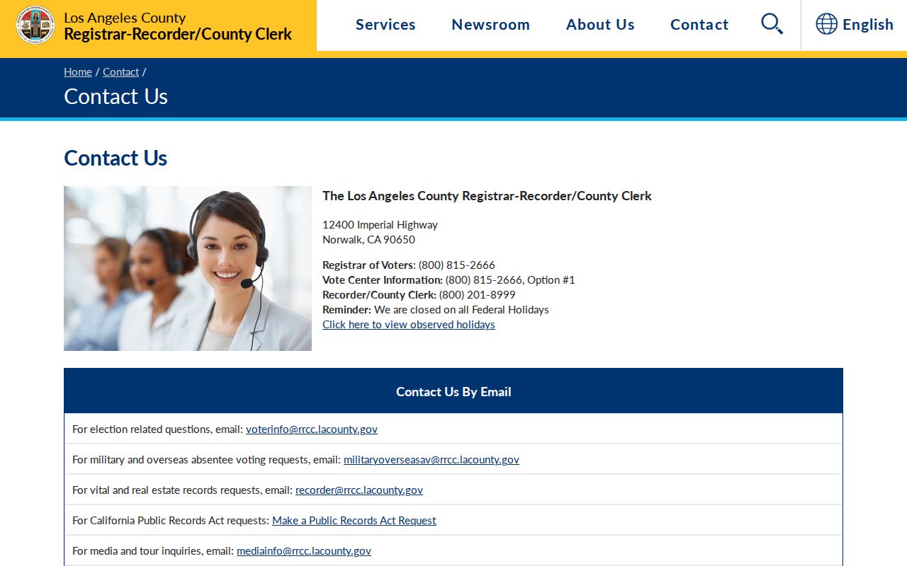
The county contact page is the practical fallback when a ZIP-related question must be routed to the right office.
The main Los Angeles County Registrar-Recorder/County Clerk service page provides the broader county entry point for recorder, clerk, and election functions.
Keeping the office names separate prevents a postal question from being sent to a custodian that cannot answer it.
Monrovia ZIP Boundaries and Jurisdiction
Postal city, situs, and jurisdiction are related but different labels. A ZIP code routes mail through a delivery network. The situs locates a parcel for tax and planning purposes. Monrovia zoning maps speak to the incorporated city, while county GIS and addressing sources cover unincorporated territory. When those labels disagree, verify in order: USPS, Assessor parcel and AIN, then Monrovia zoning or city maps.
- ZIP
- A five-digit USPS routing value for delivery territory, not a legal city boundary.
- ZIP+4
- The standardized four-digit extension returned for a full address when USPS can identify a more precise delivery segment.
- PO-box ZIP
- A ZIP used for post-office-box delivery. The inspected USPS text did not establish that 91017 is exclusively PO-box-only.
- Carrier route
- A delivery route layer within postal operations; it is not a public household roster.
- Situs address
- The physical location assigned to a parcel, distinct from an owner’s tax mailing address.
- AIN
- The Assessor Identification Number, a 10-digit parcel identifier that should retain leading zeros and displayed punctuation.
The practical effect is simple. A ZIP directory can help sort research, but a city or county record must be searched using the field that custodian actually keeps. The recorder uses indexed names and years. The Assessor uses address or AIN. The voter self-check uses four identity keys. None turns postal geography into a public list of residents.
Monrovia ZIP Data in Context
Census QuickFacts for Monrovia supplies useful scale for reading aggregate ZIP information. It lists a 2025 population estimate of 38,264, a 2020 census count of 37,931, and 13.6 square miles. Those numbers describe the city as a whole. They do not identify a named resident, assign a parcel to a ZIP, or replace a county or city boundary check.
The QuickFacts screenshot puts the ZIP code question in its proper place: population context can explain why a ZIP-level total is not a household index.
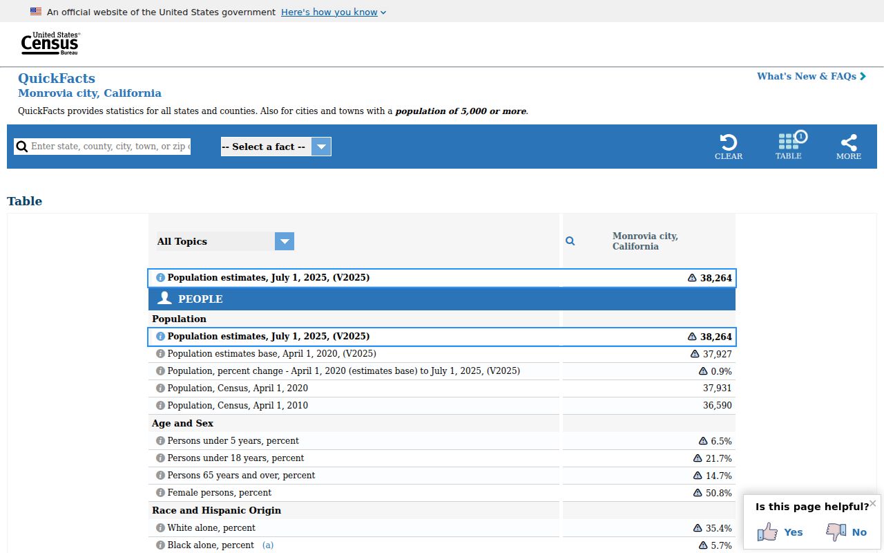
The city’s foothill setting, older tracts, later development, and surrounding county territory make a postal label a useful starting clue rather than a final geographic answer.
Compare ZIP Research Paths
Two kinds of search path may appear to produce the same answer, but they carry different weight. The distinction matters when a ZIP code directory result is used for family history, reconnecting, parcel curiosity, or civic research.
Official postal and parcel path. USPS supplies the delivery code. The Assessor supplies address or AIN parcel facts. GIS supplies mapped adjacency. The city and county supply jurisdiction and record-request channels. Each result names its custodian and its limit.
Commercial compilation path. A commercial service may merge public sources, older data, and modeled associations. It can lag a custodian, combine people with similar names, or repeat a postal city as if it were a legal boundary. It can be a lead, but it does not replace USPS, the Assessor, GIS, RR/CC, or an authorized election record.
When a compilation conflicts with an official source, save the precise field that conflicts and ask the custodian about that field. Do not expand a ZIP clue into a claim about a household.
Lawful Monrovia ZIP Research
ZIP code research is appropriate for personal genealogy, reconnecting with a known person, checking a parcel’s public geography, and understanding aggregate civic information. California’s voter rules, public-record exemptions, and Safe at Home address-confidentiality program place limits on what can be copied or republished. Protected participants may have a substitute address, and a missing residential address can be a lawful protection rather than an error.
The voter status form is not a block browser. Elections Code Sections 2180-2194 restrict voter-file access and bar commercial use. The California Secretary of State voter-file request route and Los Angeles County describe separate channels for permitted users, with purpose and security conditions. A ZIP should never be used to reconstruct a protected address.
Lawful use. Use Monrovia ZIP records for personal, lawful research and respectful civic or family purposes. Do not use postal, parcel, voter, or service data to stalk, harass, intimidate, or harm anyone.
Verify every meaningful conclusion with the office that holds the record. Postal territory, parcel jurisdiction, assessed ownership, voter status, and household presence are separate questions, and a careful ZIP directory keeps them separate.